Map of Bushū Toshima Area, Edo (Bushū Toshima-gōri Edo no Shōzu)
Tokyo Shiryō Collection A13-2
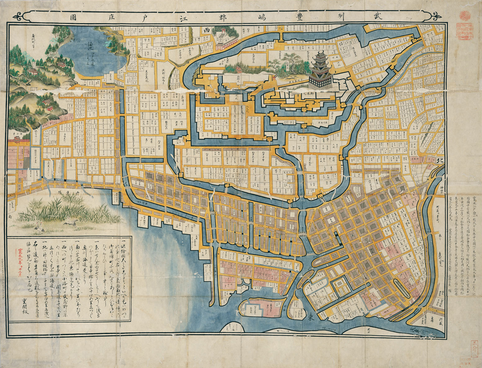
This picture is representative of early Edo period illustrations and is considered to have been drawn in 1632 (Kaei 9). It is the oldest Edo map with accurate details according to current knowledge. It allows us to know the early Edo period town.
This illustration is a copy, but the original is assumed to be the oldest published map. Beginning with the castle keep and Mt. Momiji, the pictorial technique is adapted to the topography of Nichieda Shrine, a reservoir to Mt. Atago and Zōjō-ji temple, etc., and the geographical expressions of other districts. It is said to be a transitional piece leading to the making of fully-fledged maps. Many similar types of drawings such as tracings and reproductions are in circulation and are generally called illustrations in the Kan'ei style.

