Edo Keicho Map, otherwise known as the Copy of Edo Keicho Map (Keichō Edo Zu)
1845 (Kōka 2) Tokyo Shiryō Collection A11-2
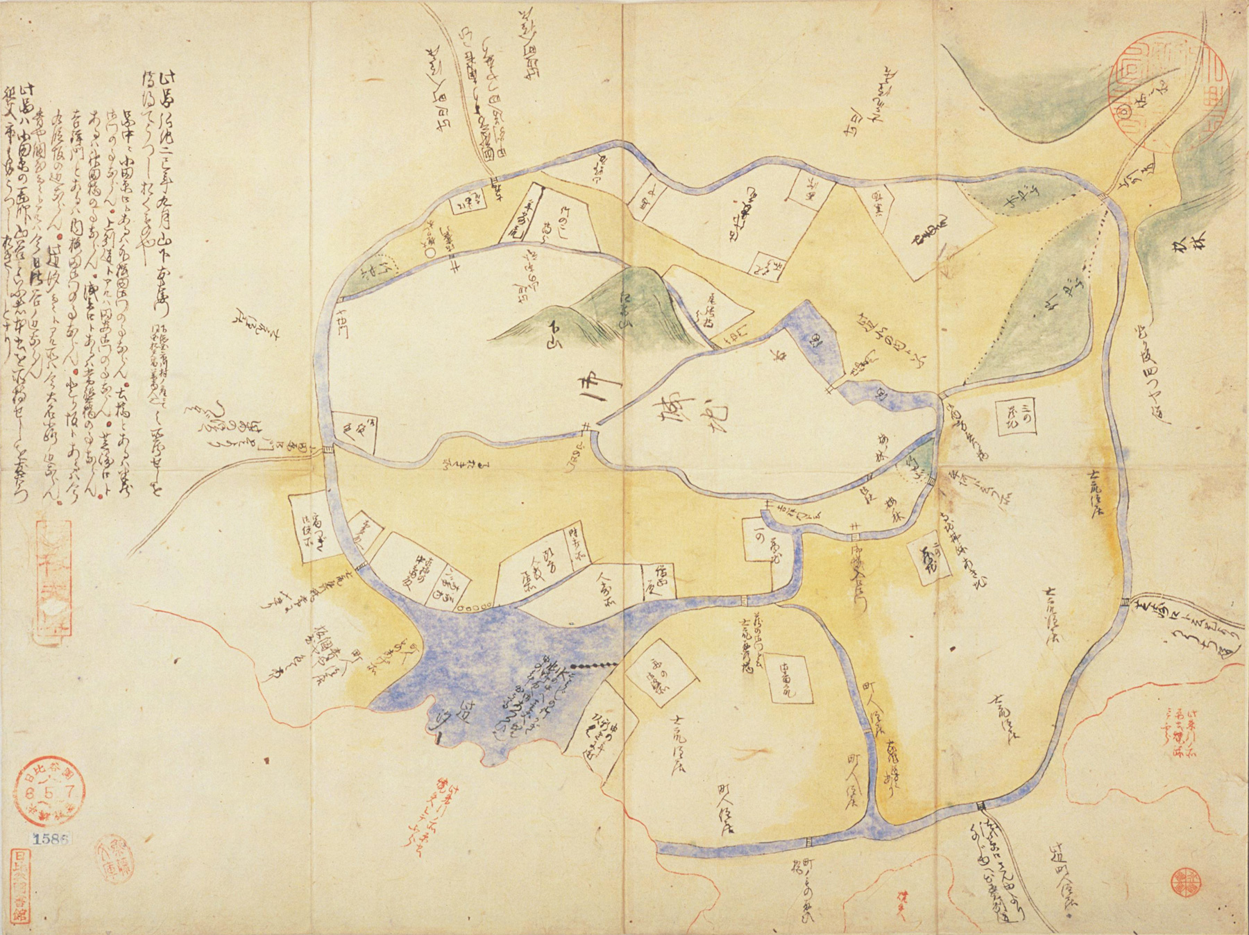
This illustration is thought to be the first map of Edo created in the Edo period. It was not drawn based on a survey but is a simple sketch, but it is of considerable importance in terms of the history of maps.
This map depicts the castle (Oshiro) in the center and includes the area up to the present day inner moat. The lower right area where the sea makes ingress into to land is thought to be the area from the present day Imperial Palace Square to Shinbashi Station. Based on the names of people in the map and the fact that the inlet was reclaimed in 1603 (8th year of Keichō), it is assumed that it is a depiction of Edo's townscape in the year 1602 (7th year of Keichō).
There is a notation in the top left area saying "This picture was copied from the collection held by Tomoemon Yamashita in the ninth month of the second year of Kōka, the year of the snake". It is also said to be the 'Revised map of Keichō Edo' and 'Map of Edo in the seventh year of Keichō'.

