Illustration of Edo with its New Additions (Shinten Edo no Zu)
1657 (Meireki 3) Tokyo Shiryō Collection A17-1ア
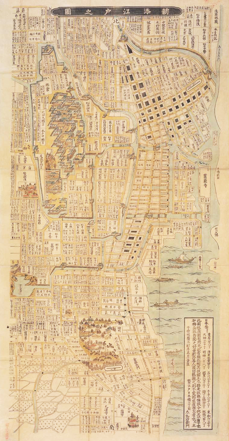
This is an illustration that allows us to understand what the city of Edo looked like during the early Edo period. Normally, Edo maps are drawn with the west at the top, but this map is notable for being drawn long top to bottom with north at the top so that Asakusa appears at the top of the map, Shiba is at the bottom, the sea is to the right and Aoyama is to the left.
The extent of the Edo town in the early Edo period was limited to the space of the present day Chiyoda Ward, Tokyo and its surrounding areas and construction was carried out in such a way as to surround the outer moat of Edo Castle. However, the size of the town gradually grew due to the population increase that occurred later.
The title of 'Shinten' refers to the new addition of the town towards the south west. It is also by this title that we can know of the town's growth.
The open edition was documented as of the 'New Year day of the third year of Meireki, Kisshin (Good Day)' but it is considered that the completion of this work was two or three months previously in 1656 (second year of Meireki). The Great Fire of Meireki occurred in January 1657 (third year of Meireki) and so the 'Shinten Edo Map' is a precious resource allowing us to understand the Edo City layout immediately before the fire.

