Illustrated Map of Tamagawa Aqueduct (Tamagawa jōsui ezu)
Year of production unknown Tokyo Shiryō Collection 760-20
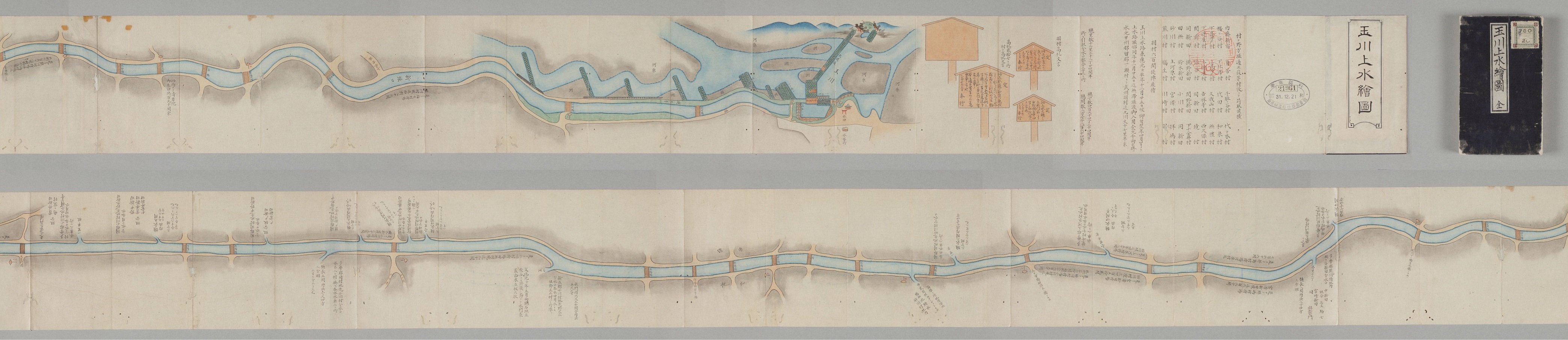
This map shows the route followed by the Tamagawa Aqueduct from the intake weir in Hamura right through to Edo Castle.
Edo's major water sources were the Tamagawa and Kanda Aqueducts. In the early Edo period, townsfolk used the Kanda Aqueduct and Akasaka Reservoir for drinking water, but water shortages developed as the city grew, and plans were drawn up in 1652 for the construction of the Tamagawa Aqueduct. The Kanda Aqueduct was used mainly to supply the northern part of Edo, while the Tamagawa Aqueduct served the south. Water originating in the Tamagawa River was carried by the aqueduct some 43 kilometers from Hamura to the Yotsuya Gate, and then by a network of stone and wood pipes to Edo Castle and downtown Edo. As well as being used for Edo's drinking water, the Tamagawa Aqueduct supplied the villages of the Musashino plateau with water for daily use and irrigation, playing a major role in the development of new rice plantations.
The image is only a part of the picture.

